
12.30.2005
Year of the Satellites
 Way back in 1982, Time magazine's Person of the Year was a machine: the computer. Those were the days. And why not? Time defines "Person of the Year" as "the man, woman, couple, group, idea, place, or machine that -- for better or worse -- has most influenced events in the preceding year."
In the spirit of that, this year, for the person, idea, machine, whatever-you-call-it of the year, while as everyone has heard, Time honors three globally famous good Samaritans as its 2005 Persons of the Year, I'd like to cast my vote for the non-human Samaritans of the year: the satellite.
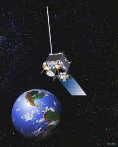
But is it possible to 'influence events,' to use Time's criteria, by orbiting above them? You bet. Of course, there are more than 800 active satellites currently in orbit around earth, (most of which belong to the US,) and many of them qualify, one way or another, for this year's honor. I'm talking about satellites that helped in disaster recovery. In 2005, a year marked by calamities (including the aftermath of the tsunami that hit in the last week of 2004), satellites were heroes.
With regard to hurricanes Katrina and Rita, SIA chairman Tony Trujillo testified before Congress that satellite communications "played a critical role during the response to these man-made and natural disasters. When the telephone and broadcast networks went down, satellites remained on the job. Satellites connected emergency personnel and other first responders. Satellites reunited families. Satellites reconnected communities. And, satellites enabled the world to witness the devastation of these disasters and also the many acts of heroism." (Sept. 29, 2005)
Trujillo quoted FCC Chairman Martin who said, "if we learned anything from Hurricane Katrina, it is that we cannot rely solely on terrestrial communications”.
As Futron and GVF explain in this white paper, satellite communications are "essential" for disaster management and relief.
Of course, having "eyes in the skies" is about more than communications. It's about imagery too. And lots of remote sensing satellite talent came into play in this year of natural disasters. One good example, as Leonard David reports -- to appraise hurricane damage as well as plan recovery efforts the Department of Defense's National Geospatial-Intelligence Agency helped merge both classified and commercial satellite data for FEMA.
All year, satellites did not take off a day. One year after the Asian tsunami, satellites are still helping relief and rebuilding efforts. (Spy satellites zoomed in to help victims there, too.) And satellites are helping scientists understand the dynamics of the deadly tsunami.
In Kashmir, researchers use satellite data to pinpoint the fault that caused October's deadly earthquake, to understand the "earthquake cycle" and plan emergency response in the wake of future quakes. And maps made from satellite images support ongoing relief efforts in Pakistan, northwest India and Afghanistan.
Satellites make the world smaller, as well as safer. They can work remotely to pitch in globally. For the International Charter on Space and Major Disasters, the system set up to provide "space data acquisition and delivery to those affected by natural or man-made disasters," it was quite a busy 2005. For the first time, even the US found itself beneficiary of Charter activations (for post-hurricane Louisiana, Mississippi, and Alabama.)
Of course there is nothing that satellites can actually do about the weather. But they provide nonstop coverage. And although satellites are non-political by nature, they sometimes appear to take sides, such as in the ever-heated climate change debate. (Alas, data interpretation is no satellite's forte.)
Unlike some camera-mugging celebrity Samaritans, satellites generally prefer to keep a low profile. But people take notice anyway. In his 2005 roundup in Via Satellite, telecomm lawyer Owen D. Kurtin of Brown Raysman noted "[e]normous press attention was given this year to industry players such as Orbimage and Digitalglobe for providing high-resolution images for a variety of commercially useful purposes such as disaster rescue and recovery, navigation, agriculture, traffic flow, meteorology, and security."
What else? Oh, satellites love animals. This year GPS satellites helped track endangered giant pandas in the wild. (Ok, the panda's were having sex. And yes, satellites can be voyeurs. But there is no rating system for satellite data.)
From LEO to GEO, sleepless satellites never fly from danger. And their ranks keep growing. A few days before the year closed, Europe finally launched its first Galileo satellite in the system that will rival US's GPS.
So while every day of the year satellites act as our high-flying Samaritans -- even, I'll say it, orbiting superheroes -- handling communications, navigation, remote sensing, meteorology, security and more -- in 2005, I think it is safe to say satellites may have covered more high ground than Bono, Bill and Melinda put together.
* * *
Happy new year, everyone!
![]()


